-
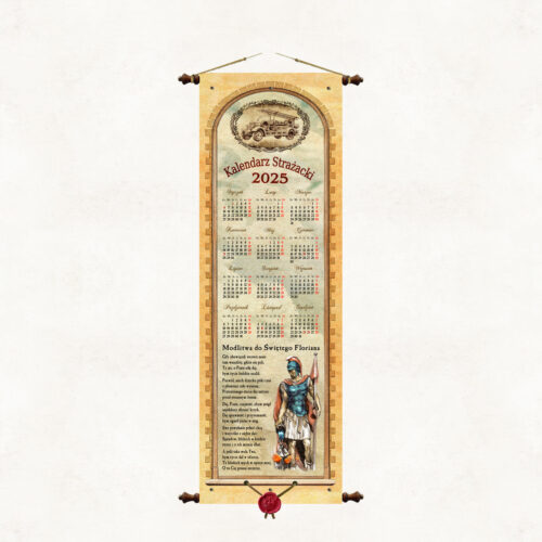
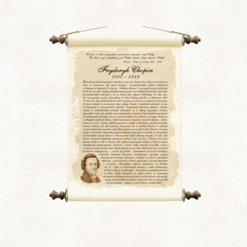
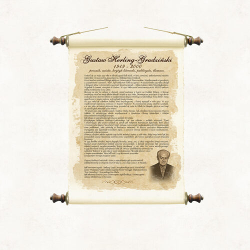
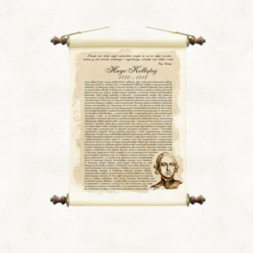
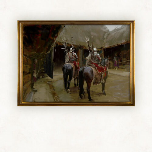
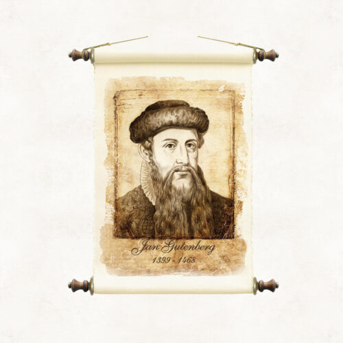
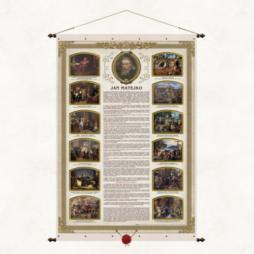
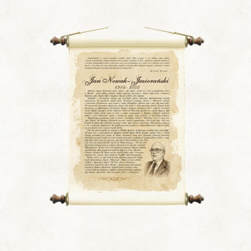
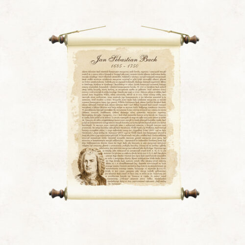
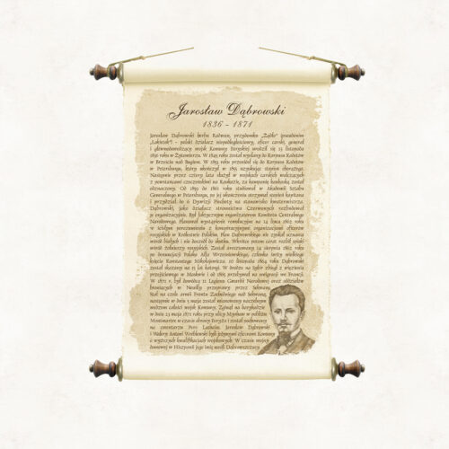
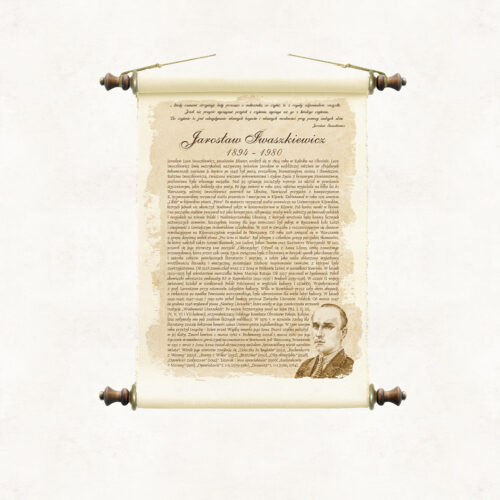
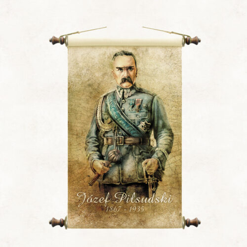
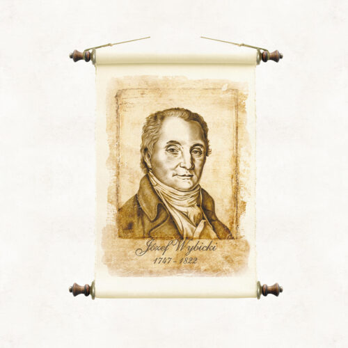
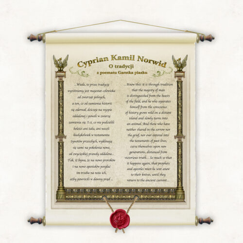
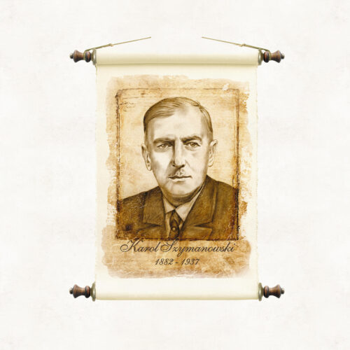
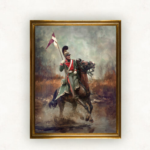
BASIC OFFER The paintings we offer are available in two widths, depending on the image's orientation: – Landscape paintings are 95 cm wide – Portrait paintings are 65 cm wide. The price of the paintings does not depend on the width, but on whether they are printed on canvas or paper, and on the type of frame or frameless frame. Their height varies and depends on the proportions specified by the artist. The price for both widths is the same and is: – Canvas print on a roll: PLN 490.00 / 1 m² – Canvas print on stretcher bars: PLN 590.00 / 1 piece – Canvas print with Pergamena frame: PLN 550.00 / 1 piece – Double-sided laminated paper print with Pergamena frame: PLN 470.00 / 1 piece FRAMES We do not sell framed paintings. The frames shown in the painting visualizations are for illustrative purposes only and are not part of our sales offer. AUTOGRAPH Paintings from our gallery are signed by the artist on each canvas and confirmed by a certificate of authenticity. LARGER FORMAT PAINTINGS We also offer paintings in larger formats. They are sold only in rolls for individual framing. The cost of larger format paintings is the painting's surface area in m², calculated including a 6-centimeter margin, multiplied by PLN 490.00. For example, the actual canvas dimensions of a 110 cm x 80 cm painting, including the margin for framing, are 122 cm x 92 cm. Due to technical constraints, the maximum height of landscape paintings offered is 135 cm, and the maximum width of portrait paintings is 135 cm. Additionally, we add domestic shipping costs of PLN 15 for rolls and bound parchments, and PLN 35 for stretcher paintings. International shipping costs are calculated individually depending on the country and carrier. PERGAMENA BINDING Pergamena Publishing's stylized binding – a form of framing characterized by proprietary technical solutions and an original composition of design details. The binding evokes the traditional method of hanging wall publications on wooden rods. The supporting rods are inserted at the top and bottom of the publication into sleeves created by folding the material and joining it lengthwise with decorative rivets. The rods are topped with wooden knobs with metal fittings, to which a decorative hanging cord is attached at the top. The lower part of the painting is stamped with a synthetic sealing wax image of the Piast eagle, suspended on strings.
-
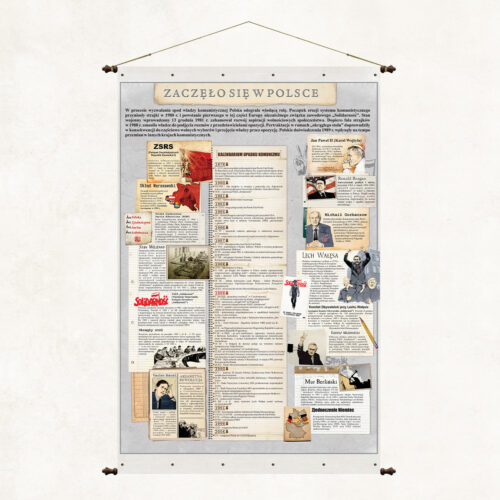
Wartościowa edukująca historycznie publikacja, której intrygujący tytuł pobudza do zastanowienia, o jakie wydarzenie historyczne chodzi. W Polsce miało początek wiele wydarzeń, ale nie wiele z nich jest tak fałszywie interpretowanych przez część europejskich historyków, jak właśnie początek i przyczyna upadku reżimów komunistycznych a szczególnie tego najgorszego – Związku Radzieckiego. Staramy się poprzez tę planszę dać udokumentowaną odpowiedź na istotne pytania dotyczące tamtego okres i tamtych wydarzeń.
-
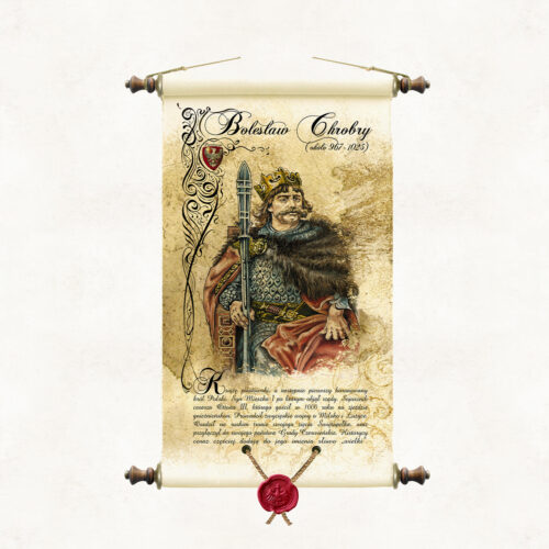
Scroll with an image of King Bolesław Chrobry, painted in watercolour by the artist of our publishing house, Marek Miha. The portrait is a colourful interpretation of drawings from the cycle Poczet królów i książąt polskich executed in pencil by Jan Matejko. BOLESŁAW CHROBRY (967 - 1025) The son of Mieszko I, the first crowned king of Poland. He was an ally of Emperor Otto III, whom he hosted in Gniezno in 1000. He waged victorious wars over Milsko and Lusatia. He organised missionary expeditions to Kyiv. He installed his son-in-law, Svyatopolk, on the throne of Kyiv, and recaptured the Chernivian lands previously occupied by Prince Vladimir of Kyiv, incorporating them into his own state. Historians are increasingly adding the word ‘Great’ to his name.
-
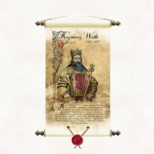
A scroll with an image of King Casimir the Great, painted in watercolour by the artist of our publishing house, Marek Miha. The portrait is a colourful interpretation of drawings from the series Poczet królów i książąt polskich (A Selection of Polish Kings and Princes) made in pencil by Jan Matejko. KAZIMIERZ THE GREAT (1310 - 1370) The last of the Piast dynasty, king of Poland from 1333. Due to the construction of dozens of new cities, as well as the expansion or construction of several hundred new castles and fortresses, he was called ‘the one who found Poland wooden and left it brick’. The talented ruler was also famous for the small number of wars fought and an effective foreign policy. His reign consolidated the unification process of the Polish lands and brought Poland out of political isolation in Europe, after nearly two centuries of district disintegration.
-
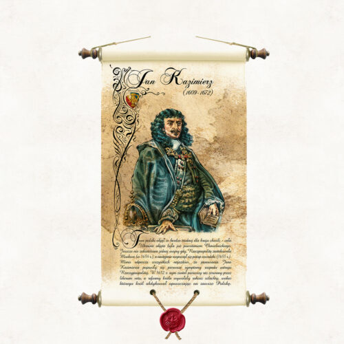
Scroll with an image of King Jan Kazimierz, painted in watercolour by the artist of our publishing house, Marek Miha. The portrait is a colourful interpretation of drawings from the series Poczet królów i książąt polskich (A Selection of Polish Kings and Princes) made in pencil by Jan Matejko. JAN KAZIMIERZ (1609 - 1672) He assumed the Polish throne at a very difficult moment for the country - the whole of Ukraine was covered by the Khmelnytsky uprising. One war had not yet ended when the Republic was attacked by Moscow (1654), followed by the Swedish deluge (1655). Despite repulsing all invasions, the first symptoms of the disintegration of the Commonwealth's political system appeared during the reign of Jan Kazimierz (the first Sejm in 1652, broken off by the liberum veto, and the nobility's rebellion). The King abdicated, leaving Poland forever.
-
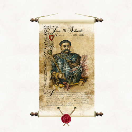
Scroll with an image of King Jan III Sobieski, painted in watercolour by the artist of our publishing house Marek Miha. The portrait is a colourful interpretation of drawings from the cycle Poczet królów i książąt polskich executed in pencil by Jan Matejko. JAN SOBIESKI (1629 - 1696) He came from a magnate family. In 1674, the nobility elected him king. Jan III Sobieski was an outstanding commander who achieved some of the greatest military successes of Polish arms, including the Battle of Chocim (1673) and the famous relief of Vienna (1683). He was also a great patron of culture and the arts. On the other hand, he did little in matters of foreign, domestic policy and economy. He did not stop the negative processes decaying the Polish state with increasing speed.
-
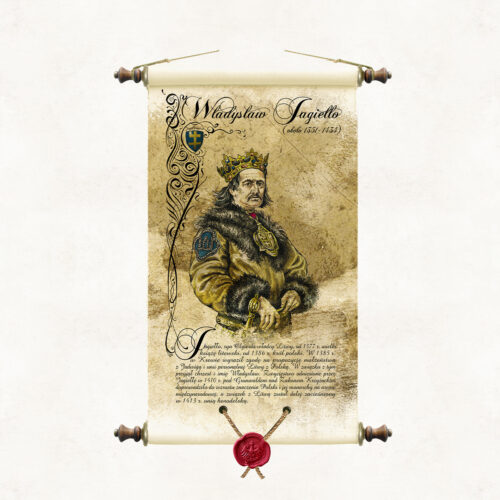
Scroll with an image of King Ladislaus Jagiello, painted in watercolour by the artist of our publishing house, Marek Miha. The portrait is a colourful interpretation of the drawings from the cycle Poczet królów i książąt polskich executed in pencil by Jan Matejko. WŁADYSŁAW JAGIEŁŁO (1362 - 1434) Jagiełło, son of Olgierd, ruler of Lithuania, from 1377 Grand Duke of Lithuania. In 1385 he married Jadwiga of Anjou and concluded a personal union between Lithuania and Poland. As a result, he was baptised and named Ladislaus. In 1386, he became the Polish king. The victory won by Jogaila at Grunwald in 1410 over the Teutonic Order led to an increase in the importance of Poland and its monarch in the international arena, and the union with Lithuania was strengthened in 1413 with the Union of Horodela.
-
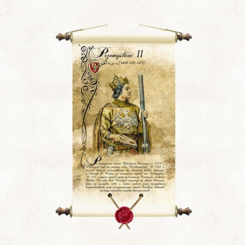
Scroll with an image of Prince Przemysl II, painted in watercolour by the artist of our publishing house, Marek Miha. The portrait refers stylistically to the series of drawings Poczet królów i książąt polskich by Jan Matejko, in which the artist did not include an image of Prince Przemysl II. PRZEMYSŁ II After the heirless death of Boleslaw the Pious in 1279, Przemysl became lord of the whole of Greater Poland. In 1282, he forced the Duke of Pomerania to pay a fief tribute. Henry IV Probus bequeathed Malopolska to him in his will. In 1295, the Pope consented to the coronation of Przemysl, as king of Poland. In 1296, Przemysl set out on a tour of Pomerania, where he was assassinated, with the unexplained involvement of Czechs, by the Brandenburg margraves.
-
BASIC OFFER The paintings we offer are available in two widths, depending on the image's orientation: – Landscape paintings are 95 cm wide – Portrait paintings are 65 cm wide. The price of the paintings does not depend on the width, but on whether they are printed on canvas or paper, and on the type of frame or frameless frame. Their height varies and depends on the proportions specified by the artist. The price for both widths is the same and is: – Canvas print on a roll: PLN 490.00 / 1 m² – Canvas print on stretcher bars: PLN 590.00 / 1 piece – Canvas print with Pergamena frame: PLN 550.00 / 1 piece – Double-sided laminated paper print with Pergamena frame: PLN 470.00 / 1 piece FRAMES We do not sell framed paintings. The frames shown in the painting visualizations are for illustrative purposes only and are not part of our sales offer. AUTOGRAPH Paintings from our gallery are signed by the artist on each canvas and confirmed by a certificate of authenticity. LARGER FORMAT PAINTINGS We also offer paintings in larger formats. They are sold only in rolls for individual framing. The cost of larger format paintings is the painting's surface area in m², calculated including a 6-centimeter margin, multiplied by PLN 490.00. For example, the actual canvas dimensions of a 110 cm x 80 cm painting, including the margin for framing, are 122 cm x 92 cm. Due to technical constraints, the maximum height of landscape paintings offered is 135 cm, and the maximum width of portrait paintings is 135 cm. Additionally, we add domestic shipping costs of PLN 15 for rolls and bound parchments, and PLN 35 for stretcher paintings. International shipping costs are calculated individually depending on the country and carrier. PERGAMENA BINDING Pergamena Publishing's stylized binding – a form of framing characterized by proprietary technical solutions and an original composition of design details. The binding evokes the traditional method of hanging wall publications on wooden rods. The supporting rods are inserted at the top and bottom of the publication into sleeves created by folding the material and joining it lengthwise with decorative rivets. The rods are topped with wooden knobs with metal fittings, to which a decorative hanging cord is attached at the top. The lower part of the painting is stamped with a synthetic sealing wax image of the Piast eagle, suspended on strings.
-
BASIC OFFER The paintings we offer are available in two widths, depending on the image's orientation: – Landscape paintings are 95 cm wide – Portrait paintings are 65 cm wide. The price of the paintings does not depend on the width, but on whether they are printed on canvas or paper, and on the type of frame or frameless frame. Their height varies and depends on the proportions specified by the artist. The price for both widths is the same and is: – Canvas print on a roll: PLN 490.00 / 1 m² – Canvas print on stretcher bars: PLN 590.00 / 1 piece – Canvas print with Pergamena frame: PLN 550.00 / 1 piece – Double-sided laminated paper print with Pergamena frame: PLN 470.00 / 1 piece FRAMES We do not sell framed paintings. The frames shown in the painting visualizations are for illustrative purposes only and are not part of our sales offer. AUTOGRAPH Paintings from our gallery are signed by the artist on each canvas and confirmed by a certificate of authenticity. LARGER FORMAT PAINTINGS We also offer paintings in larger formats. They are sold only in rolls for individual framing. The cost of larger format paintings is the painting's surface area in m², calculated including a 6-centimeter margin, multiplied by PLN 490.00. For example, the actual canvas dimensions of a 110 cm x 80 cm painting, including the margin for framing, are 122 cm x 92 cm. Due to technical constraints, the maximum height of landscape paintings offered is 135 cm, and the maximum width of portrait paintings is 135 cm. Additionally, we add domestic shipping costs of PLN 15 for rolls and bound parchments, and PLN 35 for stretcher paintings. International shipping costs are calculated individually depending on the country and carrier. PERGAMENA BINDING Pergamena Publishing's stylized binding – a form of framing characterized by proprietary technical solutions and an original composition of design details. The binding evokes the traditional method of hanging wall publications on wooden rods. The supporting rods are inserted at the top and bottom of the publication into sleeves created by folding the material and joining it lengthwise with decorative rivets. The rods are topped with wooden knobs with metal fittings, to which a decorative hanging cord is attached at the top. The lower part of the painting is stamped with a synthetic sealing wax image of the Piast eagle, suspended on strings.
More information? Call: +48 501 69 59 69